
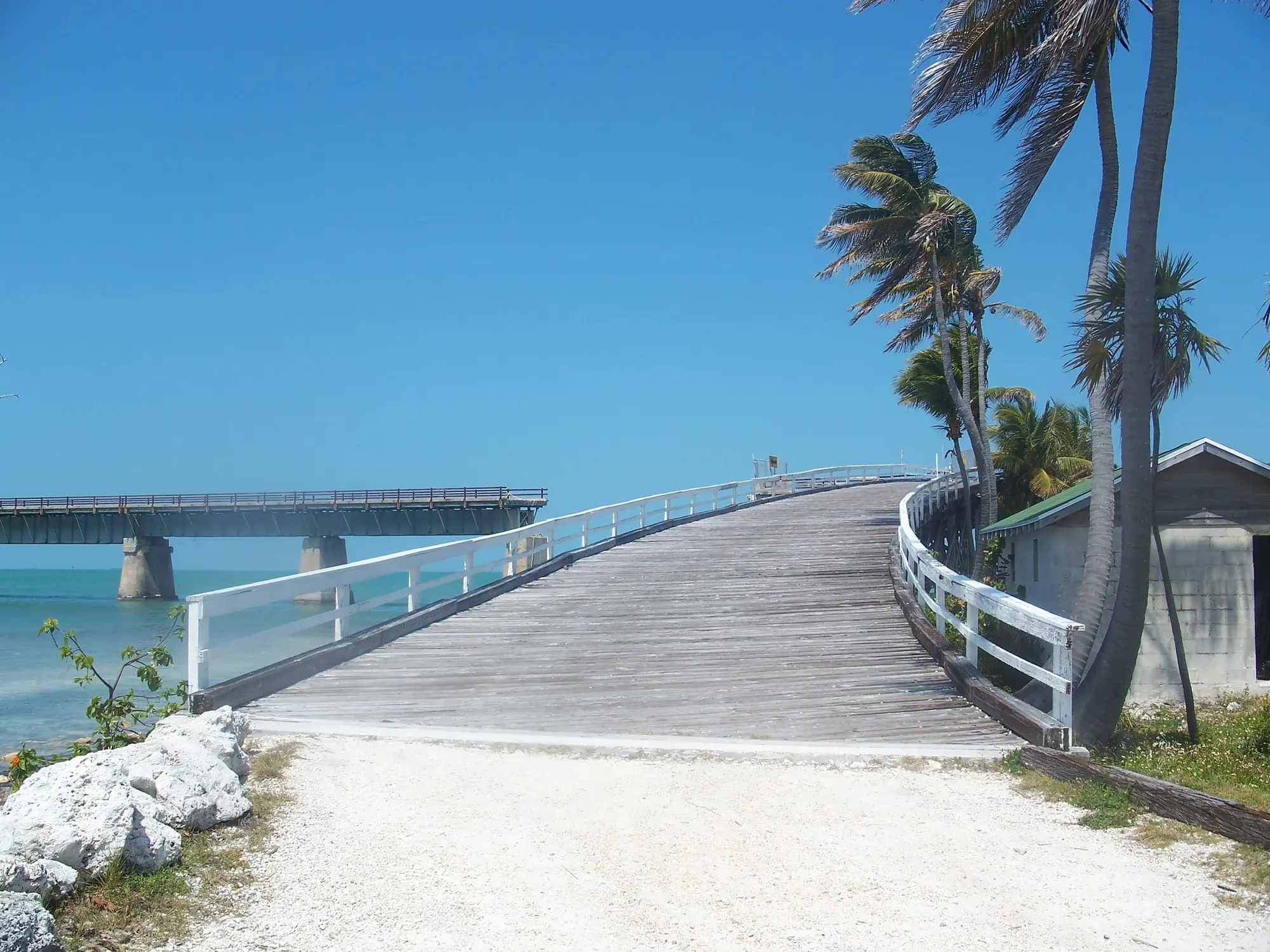

There is a paved trail running most of the way down the Florida Keys, it is free, and it crosses twenty-three railroad bridges that are over a century old. It is also not what most people assume, so here is the shape of it.
The numbers
“Florida Keys Overseas Heritage Trail (FKOHT) features more than 90 linear miles of existing trail paved in segments along a planned 106-mile corridor from Key Largo to Key West.”
Read “in segments” carefully. It is not a continuous 90-mile path. It is 90 miles of pavement distributed along a 106-mile corridor, with gaps.
Where the long ride actually is:
“the longest, continuous section of paved trail located in the Upper Keys between MM 106 at Key Largo and through MM 72 at Islamorada”
That is thirty-odd continuous miles, and it is at the other end of the Keys from Key West. If riding a long uninterrupted stretch is the goal, you are driving north to do it.
The bridges, which are the point
“Paralleling U.S. Highway 1, a designated National Scenic Highway and All-American Road, this recreational pathway incorporates 23 of the historic Flagler Railroad bridges, offering a scenic venue for hiking, running, bicycling, skating, sightseeing, fishing and paddling.”
“These bridges are part of Henry Flagler’s Florida East Coast Railway built around the turn of the 20th century. At more than 100 years old, the bridges are no longer used for transportation.”
Flagler’s Overseas Railroad reached Key West in 1912 and was destroyed by the 1935 Labor Day hurricane. What you are riding across is what survived, repurposed. It is the same story as the drive down US 1, from a different angle and much slower.
Five fishing bridges are closed for safety:
“They are the Ohio-Missouri, Ohio-Bahia Honda, Missouri-Little Duck, Lower Sugarloaf and Niles.”
Free, and open sunrise to sunset
“Hours / 8 a.m. to sunset / 365 days a year” · “Fees / No fee required”
Administrative office at 3 La Croix Court, Key Largo, FL 33037, on 305-853-3571.
The state’s own warning about its own information
In the state’s own words, and the reason to check before you go:
“Please be aware that there are community events, road projects, utility repairs, etc., that may impact the trail throughout the 106 miles of the Florida Keys. Although they impact the trail, we don’t always have control over the activities being performed by other agencies and groups and may not have up-to-date information on them.”
The state’s alert reads:
“Effective Nov. 17: The Florida Keys Overseas Heritage Trail is closed from Mile Marker 71 south to Mile Marker 71.5 for repairs. The Channel 5 bridge and parking lot are open.”
It carries no year, and it is still posted as of 23 September 2026, so treat that half-mile at Mile Marker 71 as closed. If your ride crosses it, call the trail office on 305-853-3571 first.
What it connects
“The trail offers access to many points of interest and ecological resources throughout the Keys, including Everglades National Park, Biscayne National Park, Florida Keys National Marine Sanctuary, the Great White Heron National Wildlife Refuge, Key Deer National Wildlife Refuge and Crocodile Lake National Wildlife Refuge, as well as 10 Florida State Parks.”
One of which is Bahia Honda, and the old Bahia Honda bridge is the most photographed piece of the whole Flagler railroad.
The Big Pine end, where the rules change
Once you are into the National Key Deer Refuge, the Fish and Wildlife Service takes over and the rules are different:
“Refuge lands are open to the public one half hour prior to sunrise through one half hour after sunset.”
“Biking is allowed on most rustic trails/fireroads, but not at Blue Hole, the Nature Trails or Long Beach.”
At Blue Hole — three miles north of US 1 on Key Deer Blvd — “There are no bikes allowed on this trail and bike racks are provided at the trail head to secure your bicycles.”
Two rides out here worth knowing about:
“Upper Sugarloaf Key Trail — Located on Crane Blvd, Upper Sugarloaf Key… This trail is paved and accessible to walkers, hikers and bicyclists. Length is approximately 1.5 miles or 3 miles round trip.”
“Lower Sugarloaf/Saddlebunch Key ‘End of the Road’ Trail- This 3.5 mile long (7 mile out and back) rustic trail travels the remains of old State Road 4A, the original roadway to Key West.”
That second one is the best thing on this page. The original road to Key West, abandoned, now a rustic trail you can ride out and back in an afternoon.
One hazard, from the refuge rather than the state
“Prior to visiting the rustic trails/fire roads we suggest that you familiarize yourself with poisonwood, a native plant that can cause similar skin irritation as poison ivy and poison oak. It also should be noted that American alligators, American crocodiles, and Eastern diamondback rattlesnakes all live in this refuge, although sightings are extremely rare.”
Poisonwood is the one that actually catches people. The reptiles are on the list for completeness and the refuge’s own words are “extremely rare.”
How to use this from Key West
For an afternoon: ride out along the Atlantic side and pick up the trail heading north. It is flat, it is free, and you will be on old railroad infrastructure within a few miles.
For a day: drive to Big Pine or Bahia Honda with bikes and ride from there. The End of the Road trail on Lower Sugarloaf is the most interesting short ride in the Lower Keys.
For a proper long ride: go to Islamorada and ride north. Thirty-odd continuous miles, which is the trail doing what it was designed for.
What to rent and where you can ride it is on its own page, including the e-bike rules that differ from ordinary bikes.


.jpg)